
Wadi Rum Desert Sites
Wadi Rum is a vast desert in southern Jordan, offering endless opportunities for exploration. Its dramatic landscapes and hidden natural wonders make it one of the most remarkable destinations in the region.
Having a basic understanding of the main places of interest in Wadi Rum can help you plan your visit and choose the tour that best suits your experience.
On this page, you will find an overview of some of the most notable sites within the Wadi Rum desert. For each location, we provide a short description, a photo, and in many cases a link to a related blog post or tour package that includes the site.
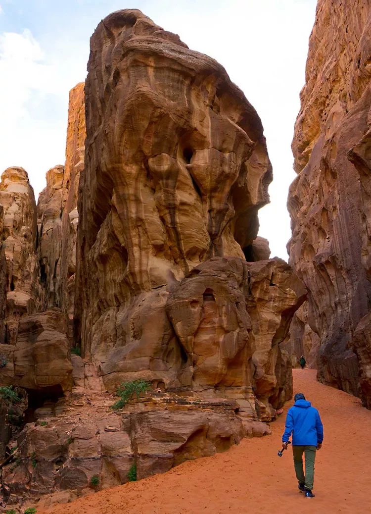
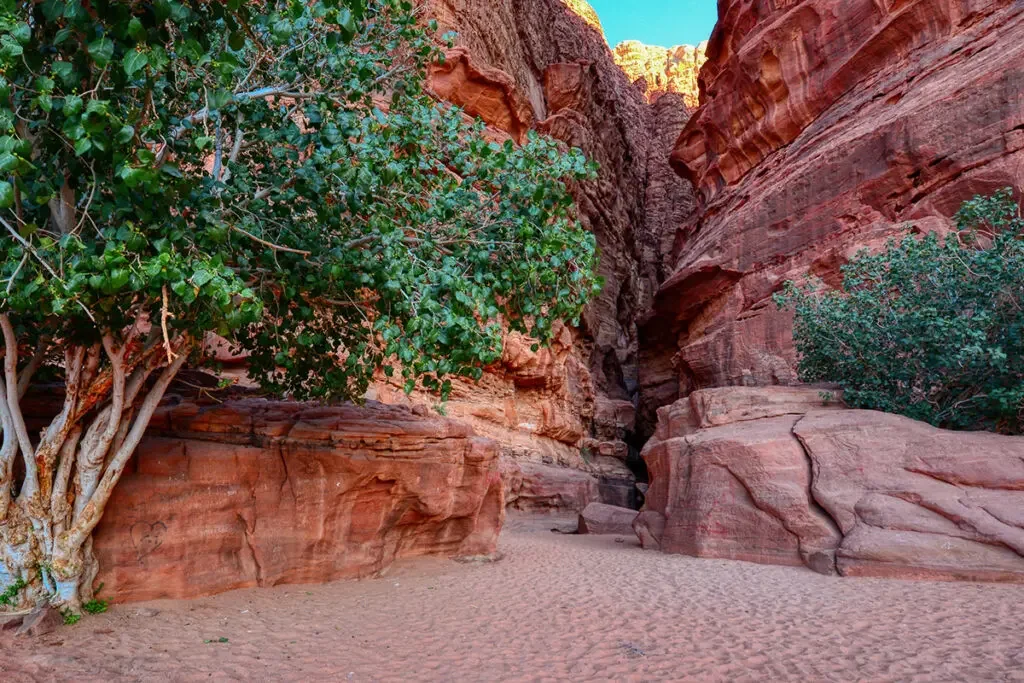
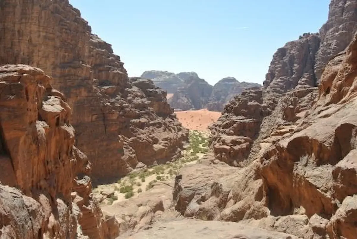
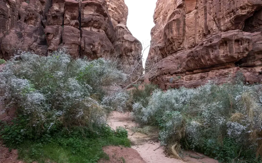
Abu Khashaba Canyon
Abu Khashaba Canyon is a beautiful canyon located in the heart of the Wadi Rum Protected Area. It is known for its striking combination of red and yellow sand and the surprising presence of desert bushes and small trees, which add a touch of green to the landscape.
The canyon has a distinctive hourglass shape, with a narrow middle section that requires a short stretch of light rock scrambling. As you walk through the canyon, you will notice the surrounding rock formations, shaped over thousands of years by wind and rain.
Many of the natural formations resemble animals, faces, and other interesting shapes, making the walk even more fascinating.
The hike through Abu Khashaba Canyon takes around 45 minutes and is included in our Jeep tours in Wadi Rum.
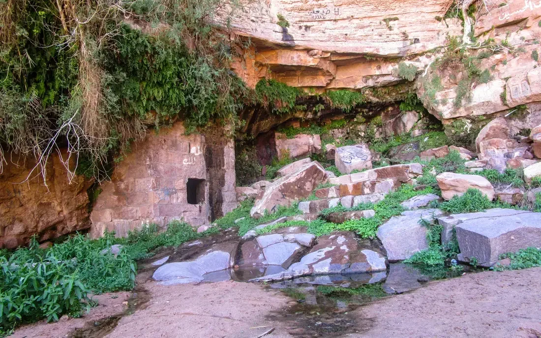
Ain Ash-Shallaleh
Ain Ash-Shallaleh is a picturesque desert spring located about a 15-minute walk along a track that begins behind the cemetery in Rum Village. The site features a small pool shaded by ferns and desert trees beside a rock-cut aqueduct, creating a peaceful oasis in the middle of the desert.
Fed by fresh mountain water, the pool provides a refreshing spot surrounded by beautiful desert scenery. The spring is also mentioned in T. E. Lawrence’s book Seven Pillars of Wisdom, where it is described as a watering place for the camels of Lawrence and Prince Faisal’s forces before their famous attack on Aqaba Fort during the Arab Revolt.
Visitors can also find ancient inscriptions carved into the rocks nearby and enjoy impressive views across the wide landscape of Rum Valley.
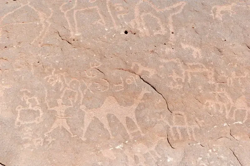
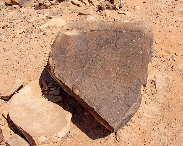
Anfishiyyeh Inscriptions
The Anfishiyyeh Inscriptions are located on the southern side of Jabal Anfishiyyeh, where a large rock wall displays some of the most impressive Thamudic and Nabataean petroglyphs found in Wadi Rum.
These ancient carvings are believed to date back around 2,500–2,800 years, offering a fascinating glimpse into the lives of the people who once travelled through this desert.
Many of the petroglyphs depict camels and their interaction with humans, reflecting the importance of camels in desert life. With a closer look, visitors can also see hunting scenes, armed figures, mysterious circular and linear symbols, and ancient inscriptions carved into the rock surface.
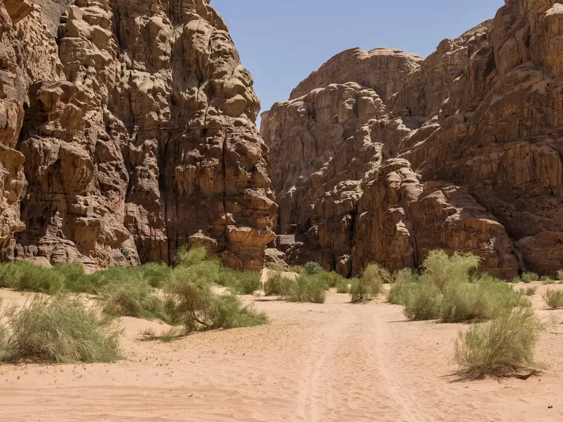
Barrah Canyon
Barrah Canyon is a 5-kilometre-long canyon that cuts through the Barrah Massif, dividing it into two sections and creating a landscape of impressive variety.
The canyon features sandy stretches, patches of desert vegetation, and dunes surrounded by colourful cliffs and rock formations, making it a great place for walking and exploring.
The hike through Barrah Canyon usually takes about 1.5 to 2 hours to complete. This trail is included in our 4D3N desert tour to Burdah Rock Bridge.
While Barrah Canyon is often considered one of the most beautiful canyons in Wadi Rum, the desert also hides many other lesser-known canyons that offer their own unique scenery and quieter atmosphere.
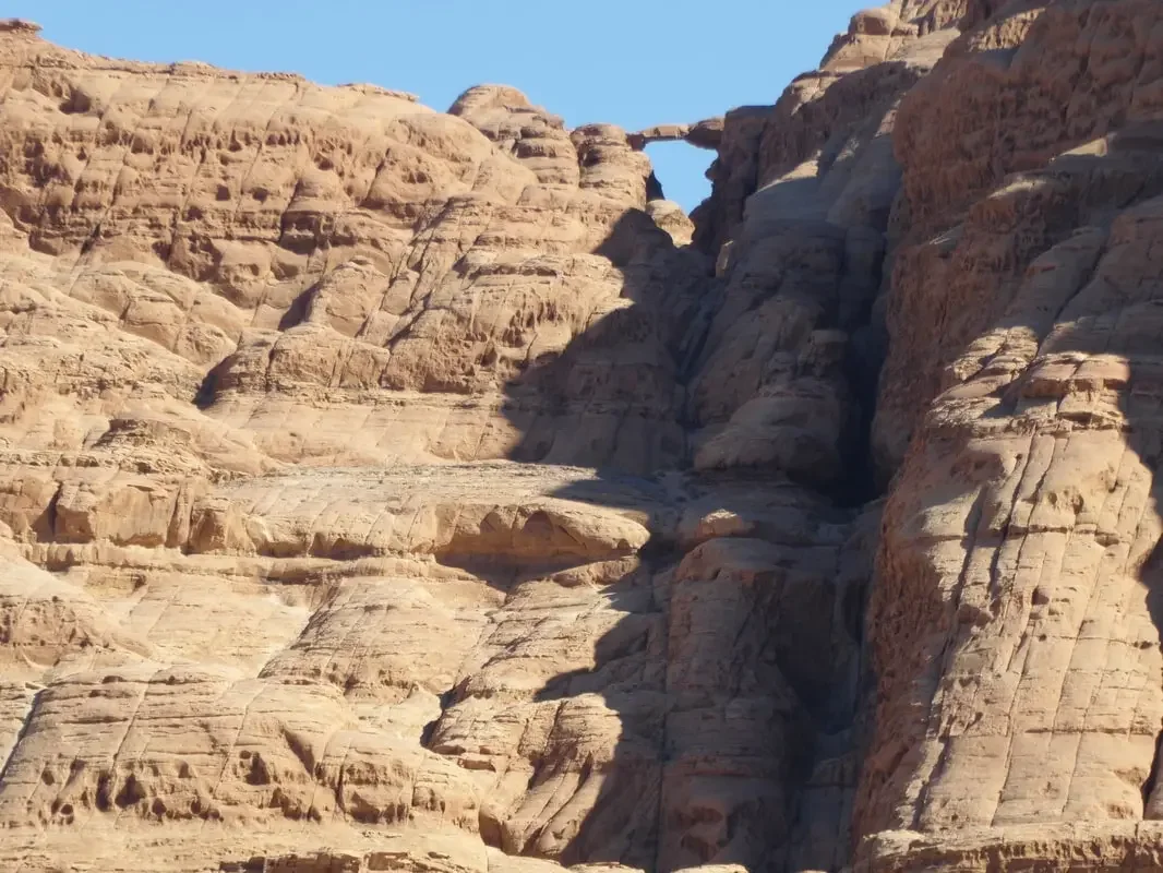
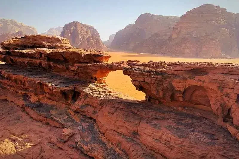
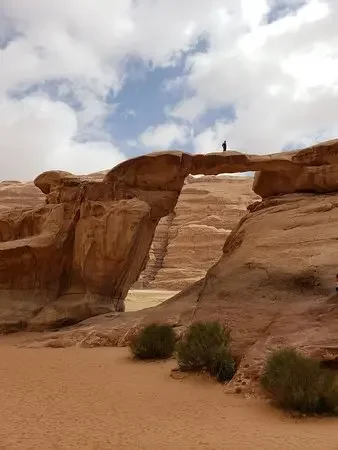
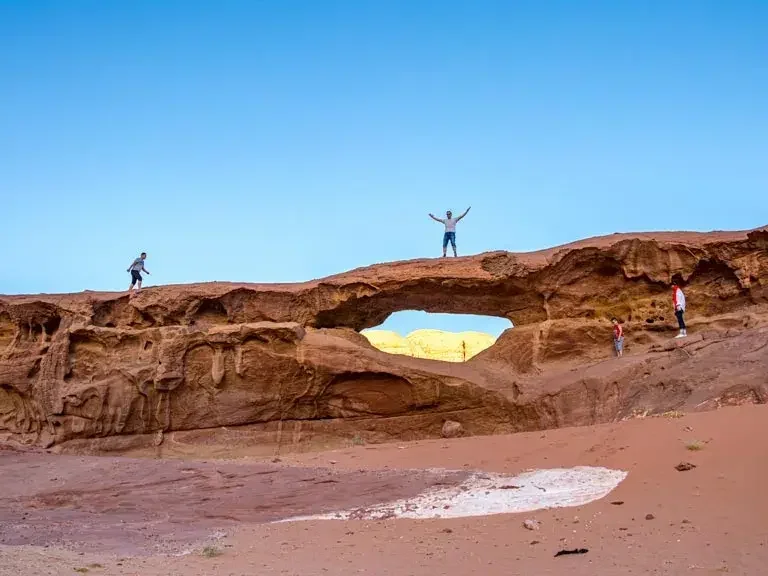
Burdah Rock Bridge
The Burdah Rock Bridge is one of the most impressive natural landmarks in Wadi Rum. The arch rises about 35 meters high and spans roughly 20 meters, creating a spectacular natural formation.
It is located on the north side of Jabal Burdah, at an elevation of just under 1,350 meters, making it the highest natural arch in Wadi Rum and one of the highest elevated rock bridges in the world.
Reaching the bridge requires a climb of around 260 meters, which includes sections of rock scrambling and a short rock climb. The hike usually takes about 3 hours round trip.
From the top of the bridge, visitors are rewarded with breathtaking panoramic views across the Wadi Rum desert.
Cow Rock
Wadi Rum is famous for its remarkable rock formations, including several isolated rocks shaped by natural erosion. One of the most recognizable is Cow Rock, sometimes also called Chicken Rock.
Over thousands of years, wind and sand have sculpted this rock into a distinctive and photogenic shape. Its unusual form often sparks curiosity among visitors.
When you visit this site, for example during our 2D1N desert tour to Jabal Al-Hash, take a walk around the rock and decide for yourself whether it looks more like a cow, a chicken, or something entirely different.
Double Bridge
Wadi Rum is known for its impressive natural rock bridges, including famous sites such as Um Fruth Rock Bridge, Little Bridge, and Burdah Rock Bridge. Among these formations, the Double Bridge is one of the most distinctive.
This unusual rock formation is located in an area of golden yellow sand in the quieter southern part of Wadi Rum, away from the more frequently visited locations.
Surrounded by beautiful desert scenery, the Double Bridge and its peaceful setting make it one of the most memorable natural features of the Wadi Rum landscape
Jabal Al-Hash
Jabal Al-Hash is located in the southern part of Wadi Rum, close to the border with Saudi Arabia. This mountain is a fascinating place for those who enjoy exploring the desert on foot.
Hiking along one of the traditional Bedouin routes on the mountain offers the chance to discover fossils, sparkling salt crystals in the sand, and desert plants traditionally used for medicine.
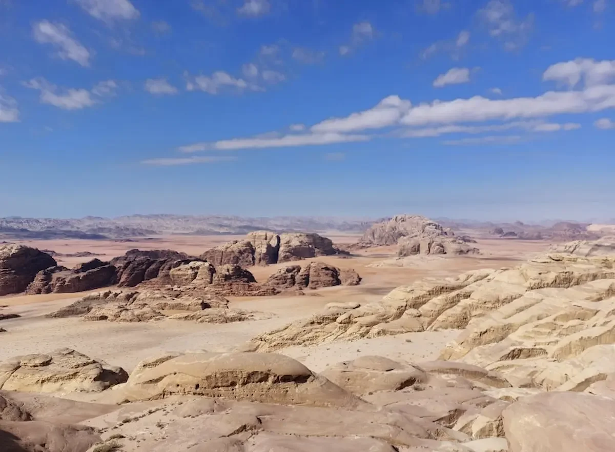
There are several hiking routes across Jabal Al-Hash, ranging in difficulty and leading to different points on the mountain. From the higher areas, visitors can enjoy spectacular views across the northern and southern parts of Wadi Sabet, making it one of the most impressive viewpoints in the Wadi Rum desert.
Jabal Al-Qattar
Jabal Al-Qattar is one of the most striking mountains in the Wadi Rum desert. Its tall, rugged peaks rise dramatically above the surrounding landscape, giving the mountain the appearance of a natural fortress. It can be seen from many areas in the desert, especially during the beautiful sunset views from Um Sabatah.
Like Jabal Rum, Jabal Al-Qattar has a granite base topped with limestone. Limestone is a porous rock that can absorb water from rainfall. The water gradually moves downward until it reaches the granite layer below. Because granite does not absorb water, the water emerges as natural springs, which provide an important source of water for plants, wildlife, and Bedouin communities in the desert.
Jabal Umm ad Dami
Jabal Umm ad Dami is the highest mountain in Jordan, reaching an elevation of 1,854 meters. It is located in the far southern part of the Wadi Rum desert, close to the border with Saudi Arabia.
From the summit, visitors can enjoy spectacular panoramic views across Wadi Rum and into Saudi Arabia. On very clear days, it is even possible to see the Red Sea shimmering on the horizon.
The hike to the top usually takes around two hours for people with moderate fitness levels. The trail is relatively straightforward but includes sections of rocky terrain with some slippery areas, so a bit of light scrambling may be required.
Khazali Canyon
Khazali Canyon is one of the most well-known and frequently visited sites in Wadi Rum. The canyon begins with a narrow passage where visitors can see many petroglyphs and ancient inscriptions carved at different heights along the rock walls.
Most of these carvings were created by the Nabataeans and the Thamudic people and date back to pre-Islamic times. The drawings include images of camels, horses, mountain goats, ostriches, human figures, footprints, and ancient writings.
Inside the canyon, you can also find a few small handmade water pools. Reaching the upper part of the canyon requires a steep and sometimes slippery climb, which is usually not included in most tour itineraries.

Lawrence House
The structure known as Lawrence House stands on the remains of an earlier Nabataean building, with the visible walls believed to have been built during the Roman period.
Although local stories suggest that T. E. Lawrence (Lawrence of Arabia) stayed here before the attack on Aqaba, there is no historical evidence confirming this claim. Some accounts also say the building may have been used to store weapons during that time.
Today, the ruins themselves are quite modest, but the location is spectacular. By climbing the rocks behind the site, visitors can reach a small plateau with beautiful panoramic views of the surrounding Wadi Rum desert.
Lawrence Spring – Ain Abu Aineh
Ain Abu Aineh, commonly known as Lawrence Spring, is a natural spring located about 3 km southwest of Rum Village. For generations, it has provided a reliable source of fresh water for Bedouin communities, their livestock, and local wildlife.
Today, a small drainage system channels the water from the spring to reservoirs near the parking area and the nearby Bedouin settlement.
At the base of the mountain, two large rocks feature numerous Thamudic inscriptions, offering a glimpse into the ancient history of the region.
To reach the spring, visitors must scramble over rocks toward a group of fig trees. Although the spring itself is now almost dry, the climb rewards visitors with beautiful panoramic views across the Wadi Rum desert.
Little Bridge
Little Bridge is one of the smaller natural rock bridges in Wadi Rum, with a span of about 4 meters. The bridge can easily be reached from its base, and climbing to the top is considered one of the easiest rock bridge scrambles in the area.
From the top, visitors are rewarded with beautiful views over the red sand valley of Khor al-Ajram, with well-known mountains such as Jabal Khazali, Jabal Rum, and Jabal Um Ishrin visible in the distance.
Little Bridge is a popular stop and is included in many jeep tours in Wadi Rum.
The Map
At the junction of Wadi Um Ishrin and Khor al-Ajram lies an interesting site known as “The Map.” The origin of this name is unclear, but the location is notable for its ancient carvings.
A sandstone rock at this spot displays several early Thamudic petroglyphs, offering a glimpse into the history of the people who once travelled through the Wadi Rum desert.
Although some carvings have faded or been damaged over time, visitors can still identify figures such as oryx and camels. Other engravings are more difficult to interpret, yet the site—together with nearby inscriptions and petroglyphs—provides valuable insight into the ancient inhabitants of Wadi Rum.
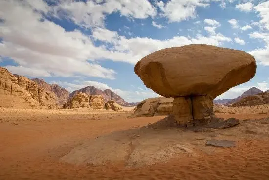
Mushroom Rock
The Wadi Rum desert is famous for its remarkable rock formations, including several isolated rocks with unusual shapes. Among them, Mushroom Rock is one of the most well-known and frequently photographed formations in the area.
Over thousands of years, wind erosion and natural weathering have shaped the rock into its distinctive mushroom-like form, creating a striking and photogenic landmark in the desert.
Mushroom Rock is a popular stop and is included in many jeep tours in Wadi Rum.
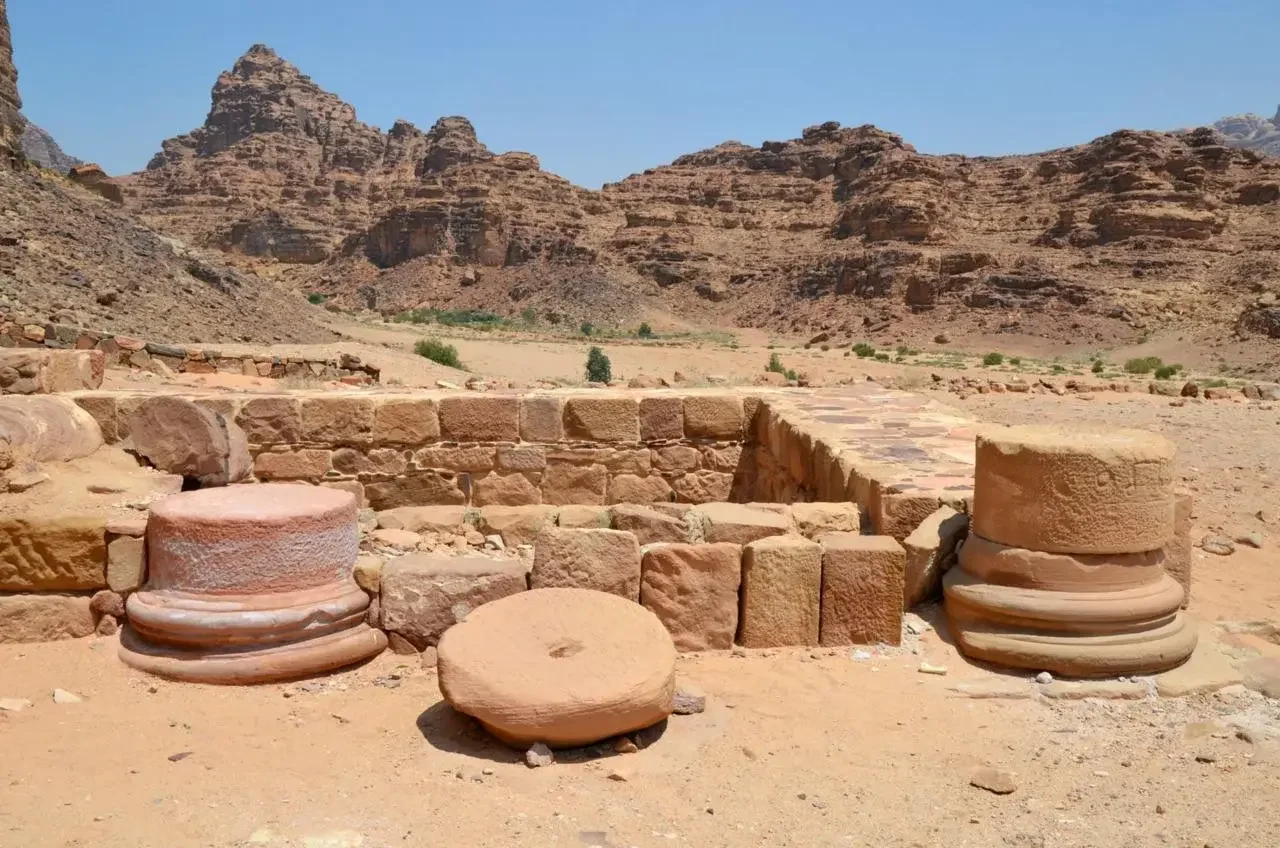
Nabataean Temple
Just outside Wadi Rum Village are the remains of an ancient Nabataean Temple believed to have been dedicated to Allat, an important goddess in Nabataean religion.
Although the structure was partly damaged by an earthquake, the surviving foundations still provide an impression of its original layout. Unlike the richly decorated façades seen in Petra, this temple was likely a simpler structure, possibly featuring a central courtyard surrounded by columns.
Nearby, visitors can also see Thamudic inscriptions carved into the rocks, offering valuable clues about the people who lived and travelled through Wadi Rum in ancient times.
Today, the quiet ruins create a peaceful place where visitors can reflect on the history and achievements of the Nabataean civilization.
Rakabat Canyon
Rakabat Canyon is a network of narrow ravines that cut through the Jabal Um Ishrin massif. The entrance to the canyon is located northeast of Wadi Rum Village.
The hike through Rakabat Canyon involves rock scrambling and some challenging sections, and the full route usually takes around three hours to complete. Because of the terrain, this hike is recommended for visitors who are reasonably fit and comfortable with heights and uneven ground.
One advantage of this canyon is the abundance of shade, which provides some relief from the desert heat. Along the way, hikers can enjoy spectacular views of the surrounding mountains and desert landscape, while also discovering the unique ecosystem of this desert canyon.
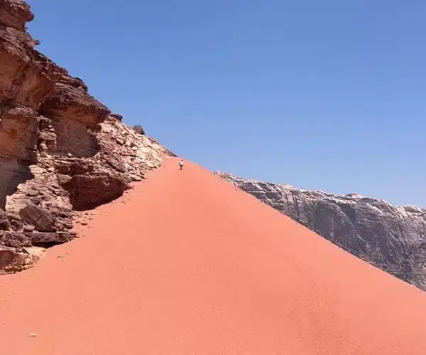
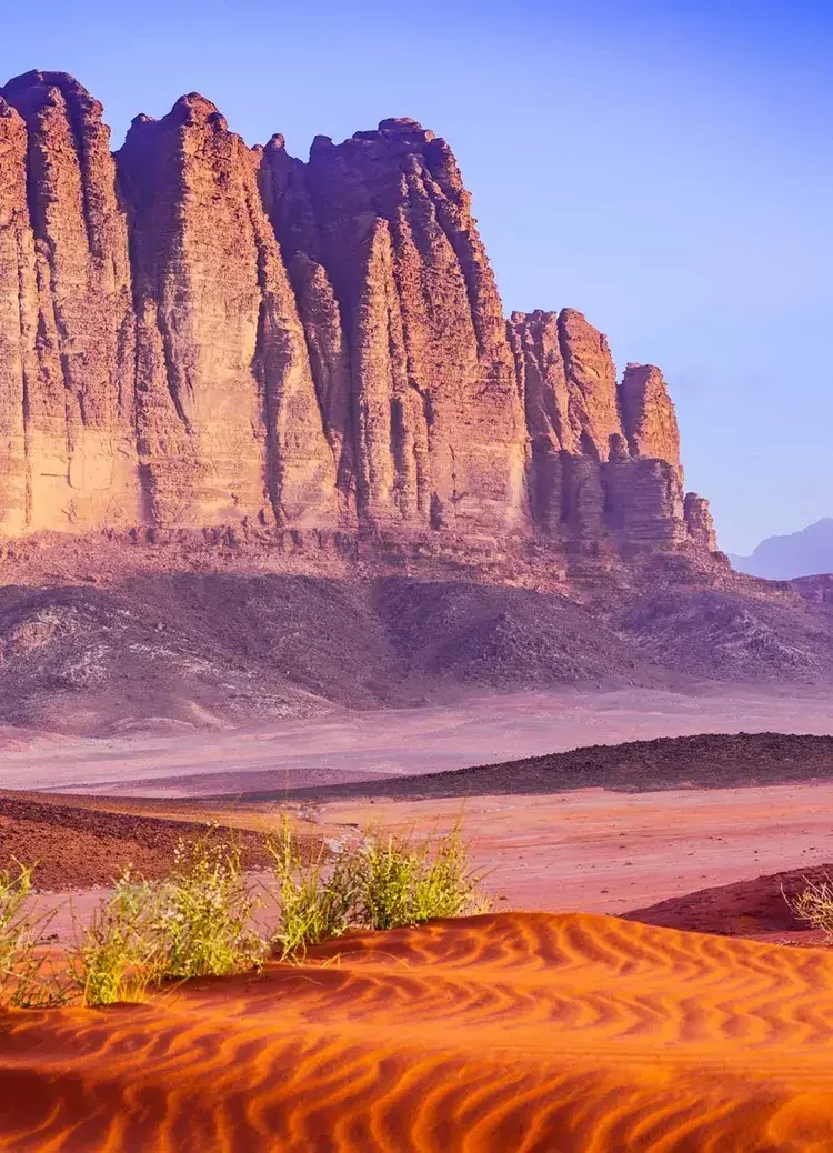
Red and Yellow Sand Dunes
Wadi Rum is famous for its red and yellow sand dunes, which appear throughout the desert landscape. Most dunes are found near rock formations, while others rise in the open valleys between the mountains.
Exploring at least one of these dunes is a highlight of visiting Wadi Rum. The highest dune in the area is Al Hasany Dune, while one of the most popular dunes is located near Jabal Khazali.
This dune is relatively easy to climb and rewards visitors with beautiful panoramic views over Khor al-Ajram and the surrounding desert scenery.
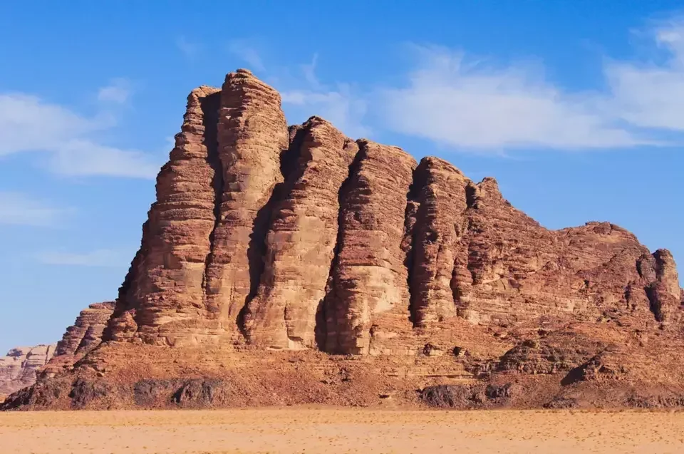
Seven Pillars of Wisdom – Jabal Al-Mazmar
The Seven Pillars of Wisdom is a mountain located opposite the Wadi Rum Visitor Centre. Among the local Bedouin community, it is known as Jabal Al-Mazmar.
The mountain became widely known through T. E. Lawrence’s book Seven Pillars of Wisdom, published in the 1920s. The title was inspired by a verse from the Book of Proverbs, which states: “Wisdom has built her house; she has carved out her seven pillars.”
Despite its name, the mountain itself does not actually have seven distinct pillars. While Jabal Al-Mazmar is not included in our tours, it can easily be seen from the Visitor Centre or while driving toward Rum Village.
Um Fruth Rock Bridge
Um Fruth Rock Bridge is one of the most famous natural arches in Wadi Rum. The bridge rises about 15 meters high and offers impressive views of the surrounding desert landscape.
Because of its unique shape and easy access, it has become one of the most photographed spots in Wadi Rum, so it is common to see many visitors at this location.
Although the climb to the top is quite steep, it is short, and with the guidance of a tour guide most visitors can reach the top within a few minutes. The view from the bridge makes the short climb worthwhile.
Um al-Samn Rock Bridge
Um al-Samn Rock Bridge, sometimes referred to as “The Eye,” is located in the southwestern part of the Wadi Rum Protected Area.
Compared with other well-known rock bridges such as Um Fruth Rock Bridge, Burdah Rock Bridge, and Little Bridge, this site is less frequently visited, mainly because of its more remote location rather than a lack of beauty.
Reaching the bridge involves a short and relatively easy hike with some light scrambling. Visitors who continue climbing a little higher on the mountain are rewarded with spectacular panoramic views across the Wadi Rum desert.
This impressive rock bridge is included in our Wadi Sabet tour.
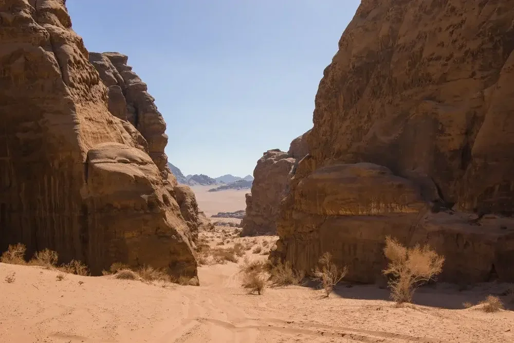
Um Mugur Canyon
Located in the northern part of the Wadi Rum wilderness area, Um Mugur Canyon is a beautiful canyon known for its soft yellow sand and striking desert scenery.
The canyon features patches of desert vegetation typical of the “white desert” landscape, creating a contrast with the surrounding rock formations. Along the hike, visitors may also spot small desert wildlife, such as lizards and different bird species.
A walk through Um Mugur Canyon usually takes around 30–45 minutes and offers a peaceful experience away from the more frequently visited areas of Wadi Rum. The views at both the beginning and the end of the canyon provide impressive panoramas of the surrounding desert.
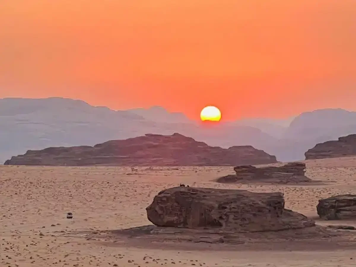
Um Sabatah – Sunset Area
The Um Sabatah area, known for its deep red sand, is located about 10 km from Rum Village. It is considered one of the best places in Wadi Rum to watch the sunset.
The valley floor, surrounding dunes, rock formations, and mountains create a perfect setting to experience the changing colours of the desert. As the sun goes down, the sky, sand, and mountains slowly shift through beautiful shades of red, orange, and gold, creating a remarkable scene.
Although it is a popular spot for photography, many visitors simply enjoy sitting quietly and watching the sunset in the peaceful desert atmosphere.
During our Wadi Rum tours, we usually stop at Um Sabatah to experience this memorable sunset view.
Wadi Nuqra
Wadi Nuqra is a beautiful yellow-sand valley stretching from Um Mugur toward Wadi Sabet. The valley is known for its diverse desert vegetation and peaceful natural scenery.
One of the most notable features of the area is the Nuqra Well, a deep natural hole that descends several meters below the surface.
The southern part of the valley becomes narrower and surrounded by impressive rock formations, creating a dramatic desert landscape. This section of the wadi is especially suitable for hiking, where visitors can observe various desert plants and occasionally spot lizards.
The hike also offers beautiful panoramic views over Wadi Sabet, making it one of the highlights of our Wadi Sabet tour.
Wadi Sabet
Wadi Sabet is a beautiful and lesser-visited valley in the southern part of Wadi Rum. Compared with the more popular northern and central areas, this region remains quieter and offers a more remote desert experience.
The valley features vast stretches of red sand running from east to west across Wadi Rum. Along its northern side, several elevated viewpoints provide spectacular panoramic views of the surrounding desert landscape.
Because of the large distances between sites, exploring Wadi Sabet often involves jeep travel, although there are also good opportunities for hiking in the valley.
The area is also rich in ancient petroglyphs and inscriptions, reflecting the long history of people who once travelled through this desert. Visitors can explore Wadi Sabet by joining our Wadi Sabet tour or one of our multi-day desert tours.